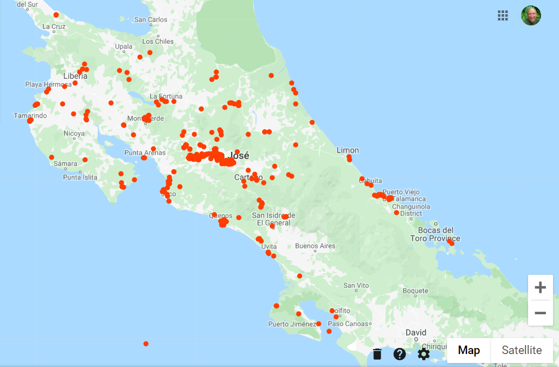
I was thinking of doing a Costa Rica Map on a cork board with map pins showing where I’ve been – which is a lot more places than most people I know here among both Ticos and Expats. Then suddenly in my electronic mailbox appears an email from Google Maps titled: Google Maps Timeline 2019 Update. Yep, it included the feature photo map above and some other stuff that seems to go back to 2015, my first year here when I began traveling Costa Rica. It seems I approved them tracking me (my cell phone) back then and this is what I get! Should I be afraid of Google or send them a thank you note? 🙂
The big red blob in the middle is the space between Atenas & San Jose that includes Alajuela and all the places I go there including the big SJO Airport. I cannot explain the red dot in the Pacific Ocean, but if you study the map more you will see the large green area in the south-southeast above Panama that has no red spots for my visits. One main reason is that it is the Talamanca Mountains, much of which is indigenous reserves with no public roads going through there plus protected national forests not allowing travel. My May trip will put me on the Western edge of that area at Chirripó and my visit to the Bribri Yorkin Reserve had me on the eastern edge. And that is it! 🙂 So just 17 more parks/reserves to go! 🙂
After 37 national parks & reserves are visited, I will do a photo book like I did with all of Tennessee’s State Parks in my photo book A Walk in the Woods Through All 54 Tennessee State Parks. There are technically only 28 national parks here! But the nine reserves count as equals and for my nature photography purposes especially, so I’m saying 37, with only 17 more to go! I don’t have a car which slows me down a little! But I will get there! 🙂
See links to the photo galleries of the 20 National Parks & Reserves I have already visited or for all of my travels over Costa Rica browse through the family of galleries:
Costa Rica Trips (80) which is the best collection of my photos here!
¡Pura vida!


